Pithoragarh3 hours ago
- copy link
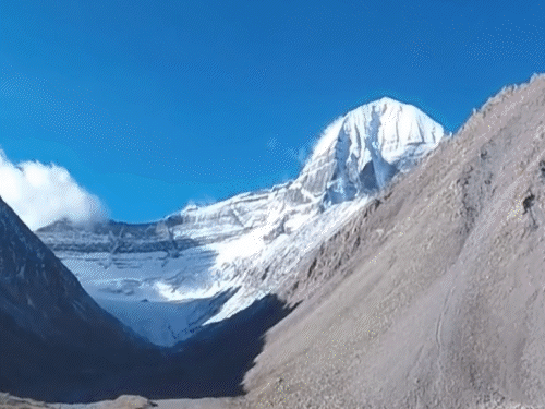
The route to Adi Kailash, situated at an altitude of 20,700 feet, is covered with a sheet of snow due to excessive snowfall this year.
Pilgrims continue to arrive in Uttarakhand to visit Adi Kailash. For the first time the devotees are traveling by road. Earlier where the journey used to take 10 days. Now the devotees are reaching within five hours.
The route to Adi Kailash, situated at an altitude of 20,700 feet, is covered with a sheet of snow due to excessive snowfall this year. This year the yatra began on May 4 and will continue till November. 32 parties have been approved. There are 12 passengers in each party.
why is this possible
An all-weather road of 65 kilometers has been built from Joljibi in Pithoragarh to Adi Kailash. Earlier it used to take 10 days from Joljibi to Gunji (Adi Kailash). Now it is taking 5-6 hours.

In Uttarakhand, a landslide occurred at Garbadhar on the Tawaghat-Lipulekh National Highway.
42 passengers were rescued
A landslide occurred 15 days ago at Garbadhar on the Tawaghat-Lipulekh National Highway. Due to the closure of this road, a group of pilgrims on Adi Kailash Yatra got stuck. The state disaster agency had earlier rescued 42 Adi Kailash pilgrims who were stranded near Tawaghat while returning from the pilgrimage after the road was closed due to heavy rains. An official said the pilgrims were mainly from Rajasthan, Gujarat, Madhya Pradesh and Delhi.
Travel time is 2 to 3 weeks
Kailash Yatra is done by 3 different highways. First- Lipulekh Pass (Uttarakhand), Second- Nathu Pass (Sikkim) and Third- Kathmandu. These three routes take a minimum of 14 and a maximum of 21 days. In 2019, 31,000 Indians went on pilgrimage, after that the pilgrimage was closed for three years.
Parikrama of Kailash 52 km
The Kailash mountain range extends from Kashmir to Bhutan. This mountain is situated between Lha Chu and Zhong Chu. There are two connected peaks here. Out of this, the northern peak is known as Kailash. The shape of this peak is like a huge Shivling. Its circumambulation has great importance in Hinduism. The circumambulation is of 52 km.
The people of Tibet believe that they should do 3 or 13 parikramas of this mountain. At the same time, many pilgrims of Tibet complete its circumambulation while offering obeisances. They believe that one parikrama washes away the sins of one birth, while ten parikramas wash away the sins of many incarnations. One who completes 108 circumambulation gets freedom from birth and death.
Part of India, but now occupied by China
When there was a war between India and China in 1962, China captured India’s Kailash and Mansarovar. Now to reach here one has to obtain Chinese tourist visa. Due to this it is not easy to go to Kailash. Mansarovar is reached after fifty types of checking by ITBP jawans and Chinese soldiers.
The Kailash Mansarovar Yatra lasts for two to three weeks (depending on where you start the journey.). The Government of India has made ‘Lipulekh Marg’ to make this journey easier. Defense Minister Rajnath Singh inaugurated this route on 8 May 2020.

Also read this news related to Mount Kailash…
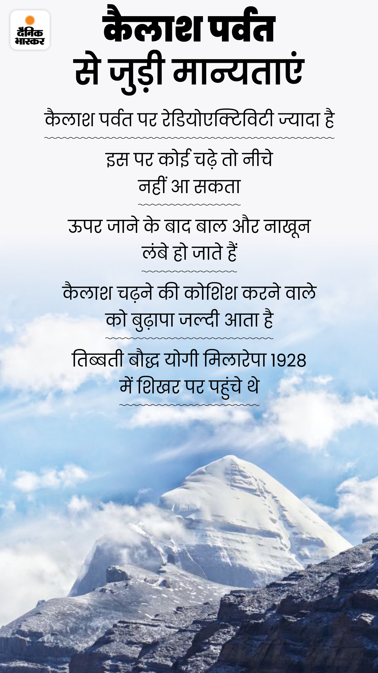
The height of Mount Kailash is less than Mount Everest: But why no one has been able to climb it till now?

During the Sino-Indian War (1962), China captured Mount Kailash. The height of its peak is less than Mount Everest. Many people have climbed Mount Everest, but till now no one has been able to climb Mount Kailash. Because of this, this mountain remains mysterious even today. Read full news…